
 Belgium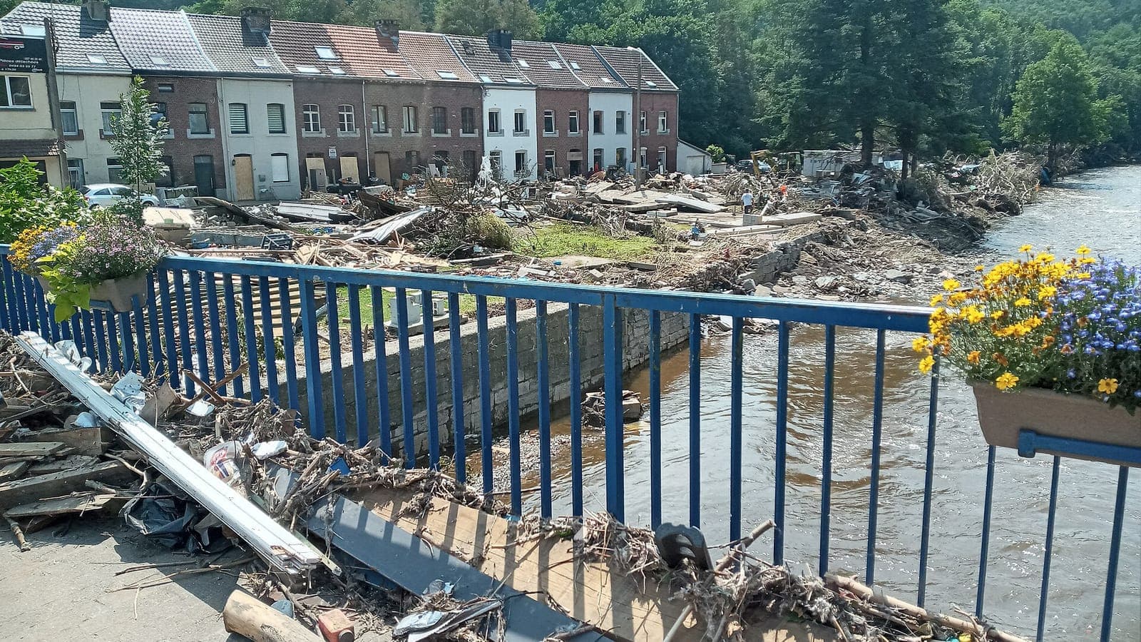
Ask a Belgian about the weather and you will hear about rain: grey, persistent, arriving from the west. That rain, together with the North Sea at the country's front door, has shaped two of the darkest nights in modern Belgian history — the storm surge of 1 February 1953 and the Ardennes floods of July 2021.
Why it rains so much
Belgium sits on the edge of the Atlantic, in the path of westerly winds that carry moist air across the North Sea. Low-pressure systems roll in one after another, especially in autumn and winter, and each brings its band of cloud and drizzle. The result is not so much heavy rain as frequent rain: Brussels records precipitation on roughly 200 days a year, though the annual total, around 850 millimetres, is modest compared with many mountain regions. It is the greyness, more than the volume, that people remember.
The picture changes towards the south-east. Where the land rises into the Ardennes, the moist air is forced upward, cools and releases more of its water. The Hautes Fagnes plateau around the Signal de Botrange, the country's highest point at 694 metres, is the wettest and snowiest corner of Belgium, with well over a metre of precipitation in a typical year. Fog lingers for days, and in winter the boardwalks across the peat bogs can lie under deep snow while Brussels, barely two hours away, sees only sleet.
The night the sea came in: 1 February 1953
On the night of 31 January to 1 February 1953, a deep depression tracked south across the North Sea while a spring tide was already running high. Hurricane-force north-westerly winds pushed a wall of water against the coasts of the Netherlands, England and Belgium. In Ostend the sea broke over the seawall and poured into the streets; at Knokke the dunes were breached near the Zwin. Along the Scheldt, the surge travelled far inland, and dikes gave way around Antwerp.
Belgium escaped the worst. Its coast is short and its dikes were relatively high, and the catastrophe fell above all on the Dutch province of Zeeland, where more than 1,800 people died. But the Belgian toll was still more than twenty lives, thousands of homes were flooded and the memory of that night stayed. It took a second warning, when the Scheldt flooded Ruisbroek in January 1976, before Belgium launched the Sigma Plan in 1977: higher dikes, controlled flood areas and, eventually, plans for a storm surge barrier on the Scheldt.
July 2021: when the Vesdre burst its banks
The second disaster came not from the sea but from the sky. In the middle of July 2021, a low-pressure system named Bernd stalled over western Europe for days. Warm, extraordinarily humid air was lifted over the Eifel and the Ardennes, and it rained without pause. At Jalhay, on the edge of the Hautes Fagnes, roughly 270 millimetres fell in 48 hours — the equivalent of several months of normal rainfall. The saturated soil could hold nothing more.
Every stream in the region turned into a torrent. The Vesdre, usually a quiet river, rose by metres within hours and tore through Pepinster, Verviers, Chaudfontaine and Trooz; in Liège, residents were urged to evacuate as the Meuse rose. Cars, bridges and whole house fronts were carried away. Around forty people lost their lives in Belgium, and the country observed a national day of mourning. It was one of the worst natural disasters in modern Belgian history, and it struck valleys that had never expected the water to reach their front doors.
Living with water
Belgium has drawn lessons from both nights. On the coast, beaches have been widened with sand, seawalls raised and the harbour of Ostend protected against a storm that statistics expect once in a thousand years. Along the Scheldt, dozens of controlled flood areas now give the river room to spread. Inland, the 2021 disaster has forced a debate about building in valleys, about how dams are managed and about warnings that reach people in time.
Forecasting has changed too. The Royal Meteorological Institute at Uccle, whose records reach back into the 19th century, now issues colour-coded warnings, and during the floods of 2021 it placed the province of Liège on red alert for rain. Meteorologists are clear that a warming atmosphere holds more water, making such stalled summer downpours both more likely and more intense. For a country shaped by rain, that is not an abstract warning.
Walk the seafront at Ostend on a windy winter day and you will feel why the dike is so high; follow the Vesdre through Pepinster and you will still see the marks of 2021 on the walls. Belgium's grey drizzle is easy to joke about, but its water has never been trivial — and the country has learned, twice, to respect it.
 Denmark
 Croatia