
 Netherlands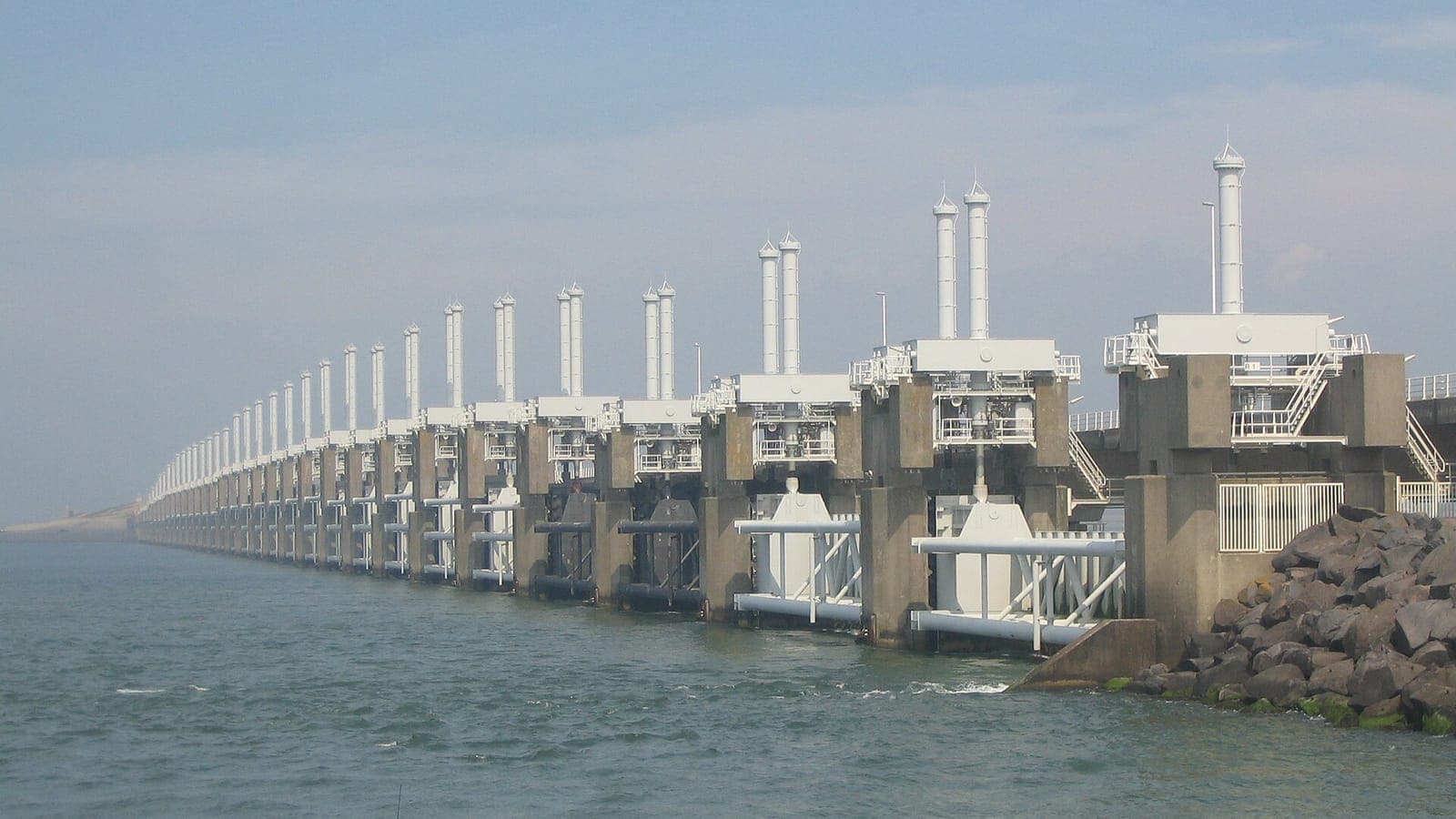
Roughly a quarter of the Netherlands lies below sea level, protected by dunes, dikes and pumps. On the night of 31 January 1953 a northwesterly storm and a spring tide tested those defences and found them wanting. The disaster, remembered simply as the Watersnoodramp, reshaped Dutch engineering for half a century.
A storm with a long run-up
The storm began as a deep low-pressure system that tracked from the Atlantic past the north of Scotland and then swung down into the North Sea. Behind it, a violent northwesterly gale blew for many hours over hundreds of kilometres of open water. The southern North Sea narrows like a funnel toward the Strait of Dover, so water driven south by the wind has nowhere to escape. Instead it piles up against the low coasts of England, Belgium and the Netherlands.
Timing made it far worse. The surge arrived together with a spring tide, when the pull of the Sun and Moon already lifts the sea higher than usual. At several Dutch tide gauges the water rose more than four metres above NAP, the national reference level, and at some it was the highest ever recorded. It was a Saturday night, many people were asleep, and regional radio had gone off the air. Warnings had been issued, but in many villages they never reached the people who needed them.
The dikes give way
In the early hours of 1 February the sea overtopped and breached dikes across Zeeland, the islands of South Holland and the west of North Brabant. Many of these dikes were old and low, and maintenance had suffered during and after the Second World War. Once water poured over the crest, it scoured away the landward slope from behind until whole sections collapsed. The sea then rushed into polders that lay well below the level of the water outside.
In the Netherlands 1,836 people died, and tens of thousands of cattle, horses and pigs drowned. Tens of thousands of people lost their homes or had to be evacuated. The same storm killed more than 300 people in Britain and more than two dozen in Belgium, and many more were lost at sea. Survivors spent the night on roofs, in attics and on the remaining stretches of dike, waiting for boats that in some places took days to arrive.
Closing the gaps
Repairing the breaches became a race against the tide, which kept flowing in and out through the gaps twice a day and scouring them ever deeper. Soldiers, volunteers and dredging crews worked for months with sandbags, woven mattresses of willow brushwood and sunken vessels. Help and supplies arrived from across Europe and North America in one of the largest international relief efforts of the post-war years.
The last and most difficult gap was at Ouwerkerk on the island of Schouwen-Duiveland. It was finally closed on 6 November 1953 using massive concrete caissons originally built for the Mulberry harbours of the 1944 D-Day landings. Four of those caissons still stand at Ouwerkerk today. They house the Watersnoodmuseum, a quiet and moving memorial to the flood and to the people who lived through it.
The Delta Works
Within weeks of the disaster the government set up the Delta Committee to make sure it could never happen again. Its answer was bold: rather than raising hundreds of kilometres of dike, close off most of the sea arms of the southwestern delta altogether, drastically shortening the coastline exposed to the North Sea. The Delta Works that followed, a chain of dams, sluices and storm surge barriers, took decades to complete and are widely counted among the great engineering feats of the twentieth century.
The plan changed along the way. When the Oosterschelde estuary was due to be dammed shut, fishermen and environmentalists protested that its rich tidal life would be lost. The compromise was a barrier roughly nine kilometres long with enormous sliding gates that normally stay open and are lowered only when a severe storm threatens. It opened in 1986. The last major piece, the Maeslantkering near Rotterdam, followed in 1997: two floating arms, each comparable in size to the Eiffel Tower, that swing shut across the busy shipping channel.
The North Sea still sends storm surges toward the Dutch coast most winters, but today they meet steel gates instead of tired dikes. Drive across the Oosterscheldekering and you see its grey pillars standing open to the tide. In villages across Zeeland, small marks on walls show how high the water rose in 1953, a quiet reminder of why the Dutch watch every northwesterly storm so closely.

 Singapore
 Argentina