
 United Kingdom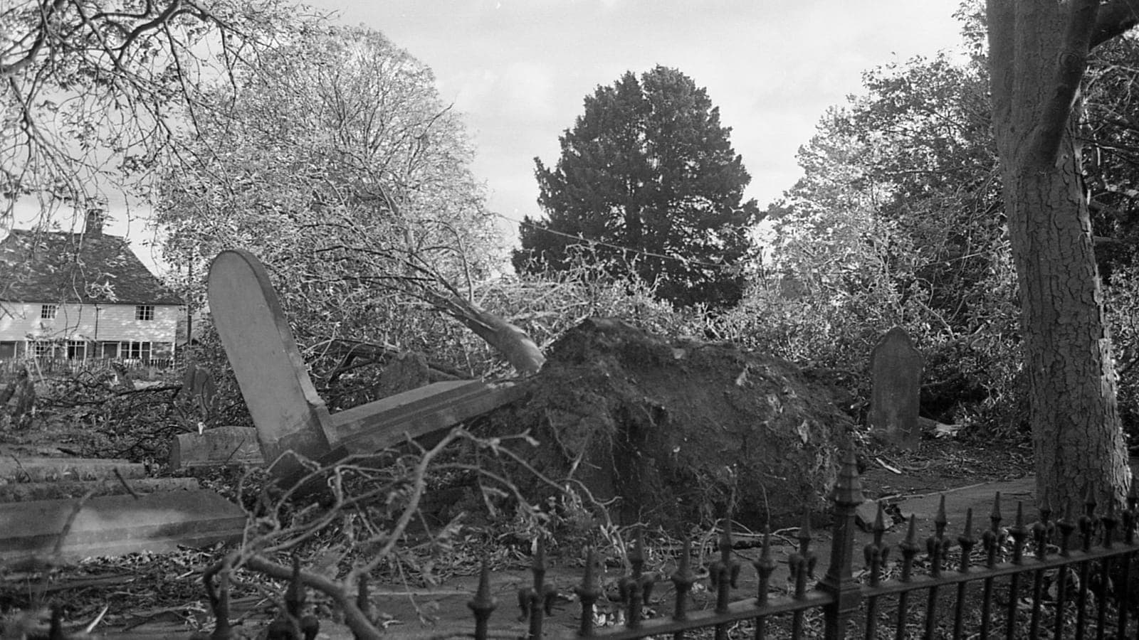
In the early hours of 16 October 1987, a ferocious storm tore across southern England while most people slept. It became the most famous weather event in modern British memory, not only for its violence but for the forecast that seemed to miss it. It also says a great deal about a country that talks about the weather more than almost anywhere else.
The forecast everyone remembers
On the lunchtime news on 15 October 1987, BBC weatherman Michael Fish told viewers that a woman had phoned to say she had heard a hurricane was on its way. Don't worry, he reassured them, there wasn't one. He did add that it would become very windy, but that part was soon forgotten. Within hours, the most destructive winds in generations were sweeping in from the Bay of Biscay.
Fish later explained that the caller had been asking about a storm elsewhere, and strictly speaking he was right: what arrived was not a tropical hurricane. But the clip has been replayed ever since, and it turned a respected forecaster into a national symbol of the weather getting the better of the experts. Fish himself has spent decades good-humouredly telling the story.
One night in the South East
The storm struck between midnight and dawn. At Shoreham-by-Sea on the Sussex coast a gust of 100 knots, around 186 km/h, was recorded, and hurricane-force winds reached far inland across Kent, Sussex, Surrey, Essex and London. Roofs were stripped, caravans overturned and a ship was driven ashore near Folkestone. Eighteen people died in England, and several more in northern France, which was hit even harder.
The greatest loss was among trees. Roughly 15 million came down in a single night, many of them still in full leaf on soft, rain-soaked ground. The town of Sevenoaks in Kent famously lost six of its seven namesake oaks, and Kew Gardens and Wakehurst Place lost hundreds of specimens. Hundreds of thousands of homes lost power, and on the Friday the London Stock Exchange barely functioned.
Not a hurricane, but something just as fierce
Meteorologically, the Great Storm was an extratropical cyclone: a deep Atlantic low that formed over the Bay of Biscay and deepened with remarkable speed as it raced north-east over the English Channel. Tropical hurricanes draw their energy from warm seas; this storm fed on the sharp contrast between cold and unusually warm air. Its gusts nonetheless matched hurricane force, which is why the word stuck.
Forecasting it was hard because computer models of the time had very few observations from the sea south of Britain, and they placed the storm's track too far south. In the early 2000s researchers suggested that the worst winds came from a 'sting jet', a narrow stream of air descending from the storm's cloud head. The phenomenon is now watched for routinely in Atlantic windstorms.
A nation that talks about the weather
The storm changed how Britain is warned. An official inquiry led to better observations over the ocean and to a more formal system of severe-weather warnings run by the Met Office. It fitted a long tradition: the Met Office was founded in 1854 under Robert FitzRoy, who began publishing forecasts in The Times in 1861 and helped make the very word 'forecast' familiar.
The weather is a national conversation starter because British weather genuinely changes fast, with Atlantic fronts passing through every few days. The BBC's Shipping Forecast, broadcast on radio since the 1920s, has become almost poetry to listeners who never go to sea. And since 2015 the Met Office and Ireland's Met Éireann have given big storms names, so the next great storm will arrive with one.
Walk through Sevenoaks today and you will find young oaks planted to replace the old ones, while gardens across the South East still show gaps and fallen trunks left as habitat. Every autumn, when the first named storm of the season sweeps in from the Atlantic and the warnings go out, older Britons remember 1987, and someone in the pub inevitably mentions Michael Fish.
 Iceland
 Norway